 Mapping assignments tend to be either data visualizations or map annotations. These two are not necessarily mutually exclusive, but tend to involve different activities. An annotated map is one in which students add textual or multimedia descriptions to points or regions on map. When the user clicks on the marker or region, the corresponding description appears. Google Maps and OpenStreetMap are very common examples of annotated maps.
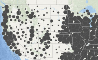
Data visualization maps are those that display some form of data, usually by color-coding regions on a map. The colors represent some numeric value associated with that region. While a rather simple tool such as Google MyMaps is capable of importing data and displaying the result, most mapping projects that involve geographic data are done with geographic information system (GIS) software, such as ArcGIS, Q-GIS, or ArcGIS Online.
Annotated maps tools allow students to add textual or multimedia descriptions to a custom map. When the user clicks on the marker or region, the corresponding description appears. These maps can then be ‘embedded’ on a course website or linked online. Google Maps and OpenStreetMap are common examples of annotated maps.
Learning goals
- Visualize course materials through a spatial lens, highlight juxtapositions and relationships between data points.
- Gain experience gathering, cleaning, and manipulating data
- Incorporate multimedia to better tell a story or present information
- Encourage collaborative, project-based work that may result in a lasting, informative artifact
Considerations
- The ArcGIS Online platform allows students to create maps, add data layers, and to share their maps with others. It is also possible to create groups within the system so that multiple people can work on the same map.
- ArcGIS Online includes access to vast repositories of geographic data that can be imported and layered on custom maps. While Google MyMaps allows one to import data, one would need to acquire and prepare that data beforehand.
- Geographic data on the web is often made available as geojson or KML files. These types of files are very well suited to online mapping tools. Larger datasets may be available as collections of data containing ‘shapefiles’. These types of files can usually be converted with GIS software, such as ArcGIS, for use on the web.
- Google MyMaps is a very attractive tool for small-scale mapping projects. Restrictions in the platform however limit how many layers may be included in a map and how much data can be imported and plotted.
- Online mapping tools provide a shared, collaborative canvas on which students can locate and position course materials. With the addition of layers of data that can be shown or hidden, students can construct a thematic archive of geo-located materials.
- Map tools can be used for geo-spatial analysis as well as for storytelling. Placing information on a map might give students a sense of the spatial relationships between events, people, and locations, but also can be presented to convey a sequential narrative.
- When seeking online resources, it is important to check the file type. This may inform what kind of tool will suit your needs. Geographic data on the web is often shared as a geojson or KML file, which is suited to online mapping tools. Collections of data containing ‘shapefiles,’ tend to be used in desktop GIS software, such as ArcGIS, but can usually be converted for use on the web.
- With the addition of the wpGeo plugin, a blog on the McGraw Commons course blog platform can become a platform for creating annotated maps. The plugin allows blog posts to be associated with specific locations and cumulative maps with markers for each post are automatically generated.
Interested in speaking with a staff member from the McGraw Center about designing a digital assignment for your course? Reach out to us at mcgrawect@princeton.edu.
Student preparation
- Advanced mapping activities such as computational analysis of geo-spatial data might require significant training and the use of desktop software rather than online tools. Contact the Maps and Geospatial Information Center in the Library for more information or to find out about training opportunities. The Center can also assist in finding the datasets needed for your project.
- Tools such as Google MyMaps, MapHub, and uMap are intuitive, freely available, and require very little training. The McGraw Center offers documentation as well as in-class training when appropriate. The Library has a significant collection of both physical and digital maps, and staff who regularly lead training sessions in ArcGIS.
Tools
- ArcGIS Online & ArcGIS StoryMaps, an online application for creating and sharing maps and for developing a wide range of mapping ‘applications’, including story-telling using narrative text, maps, and other multimedia content.
- ArcGIS, desktop geographical information systems software (Windows only)
- Q-GIS, open-source geographical information systems software
- Google MyMaps, an online mapping tool for creating personalized, annotated maps
- StoryMapJS, a visual timeline tool made available through Northwestern University’s Knightlab.
- McGraw Commons – an online pplatform for course blogs and websites
- MapHub – an open alternative to MyMaps for creating custom maps
- Palladio – a platform for data visualization focusing on relationships within data. Visualizations include network diagrams, geospatial networks, and collection galleries.
Rubrics and Resources
- Finding the Right Tools for Mapping, GC Digital Fellow, CUNY Academic Commons
- Digital Maps. Georgetown University Library
- StoryMap Rubrics from University of Minnesota
- General Mapping Project Rubrics from Geography 4 Geographers